The data for the Register was collected on 29 September 1939 and records people who were in a particular home at the time of recording.
Its initial purpose was to produce National Identity Cards, but the Register later came to be multi-functional, first as an aid in the use of ration books and later helping officials record the movement of the civilian population over the following decades; from 1948 it formed the basis for the National Health Service Register. The 1939 Register is therefore an extremely important genealogical resource for the rich detail and information recorded for each person and household.
The Register includes extra information, such as whether an individual had volunteered as an air raid warden or was a special constable. Some records have been redacted to protect the privacy of those still alive at the time of redaction so unfortunately there are gaps in the names listed for people living in and around Cowfold on 29 September 1939, and in the houses they lived in.
The entries in the Register for villagers in Cowfold and the surrounding areas such as Lower Beeding, Longhouse and Kent Street is listed as an appendix in the book on Cowfold in WW2, published in 2019.
They are also included here, by name:
and by place of residence:
Register by place of residence
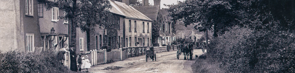
The village had fewer dwellings in the village then and most of the housing developments, including Oakfield Road, Fairfield Cottages, Alley Groves, Acorn Avenue, Holmoaks, Thornden and Barleycroft, were built after the war. A map of this period drawn by Eric Vincent is shown below:
![]() The breakdown by occupation is shown below:
The breakdown by occupation is shown below:
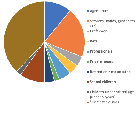
“Domestic duties” denotes a housewife, relative or other female occupant looking after a home or undertaking various duties in the home or working elsewhere as a domestic. These residents made up 38% of the community, by far the largest sector. The next largest group (20%) is services (maids, gardeners, etc), followed by agriculture (11%).