1875 Ordnance Survey Map
The team at Horsham Museum has shared a number of historic maps of Horsham with the Society, including one produced in 1875 by the Ordnance Survey.
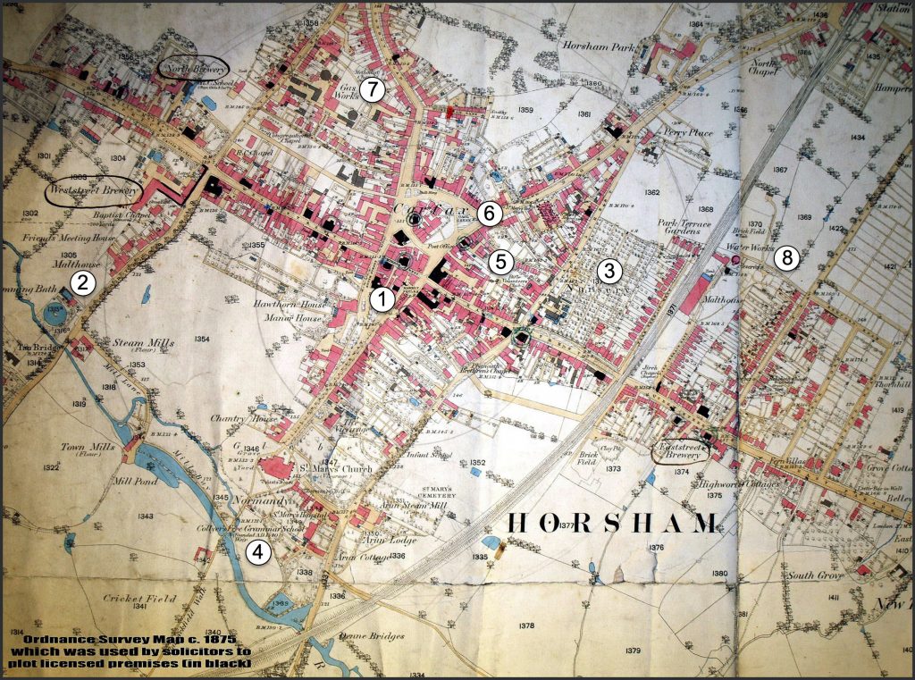
1875 Ordnance Survey Map of Horsham
This was used by solicitors to plot licenced premises (shown in black) in the town. It shows how much the town has changed over the years and a number of notable differences are highlighted below and labelled on the map:
- The old Town Hall before it was partially rebuilt.
- The town’s first swimming bath. It used a concrete disc to heat a shallow layer of water that then emptied into the pool. This heating system was, however, a commercial failure.
- The large town nursery, a well-known landmark that is now buried under housing.
- Collyers School. It moved to its current site in 1893; before the move, it stood on its original site from the 1540s.
- The rifle club, which was clearly of interest to the Ordnance Survey whereas other clubs were less so and are therefore not shown.
- Gaol Green, which was a hangover from when the Gaol was originally located on that site in the 1400s.
- The Gas Works, which created gas from coal which was used for street lighting from 1836.
- The Water Works, which was a private venture that eventually had to be bought out by the Local Board of Health.
Gough Map
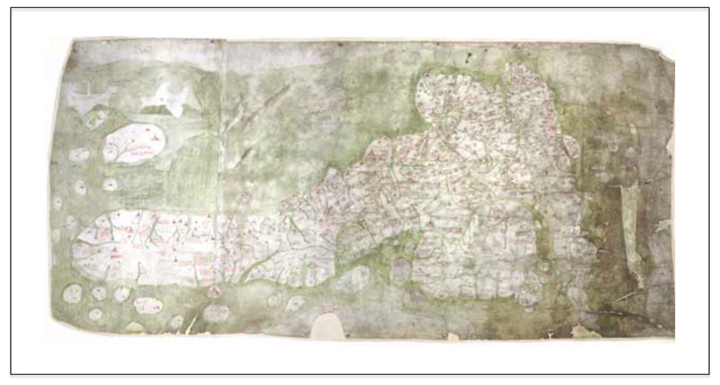
The Gough Map
Horsham appears on what is considered to be the best medieval map of Britain, the Gough map. This is currently held in the Bodleian Library and was thought to have been produced around the Fourteenth Century. (Note that the map is orientated with North pointing towards the left of the page.)
An expanded section of the map showing settlement names in the South of England, including Horsham, is reproduced below:
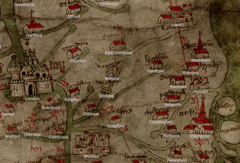
Section of the Gough Map with settlement names superimposed
For some reason the hamlet of Stopham is shown on the map but a number of larger settlements are not.
Have a look at http://www.goughmap.org/ for more detailed information on this amazing, but largely-forgotten map.