Here are a number of maps that show how Cowfold has changed over the years.
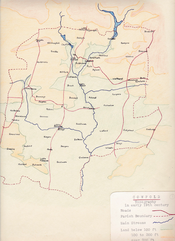
Cowfold Topology in Early 19th Century
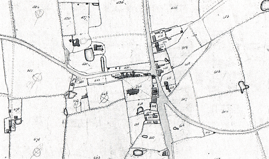
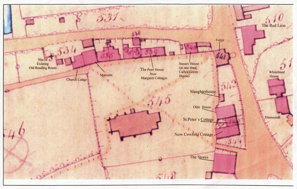
1840 Tithe Map of Cowfold
The following two maps are extracts from the Tithe Map of 1840:
Cowfold Village as shown on the Tithe Map of 1840
Extract from Tithe Map of 1840
1909 Map of Cowfold and Shermanbury
This is one from 1909 and includes sites of medieval buildings:
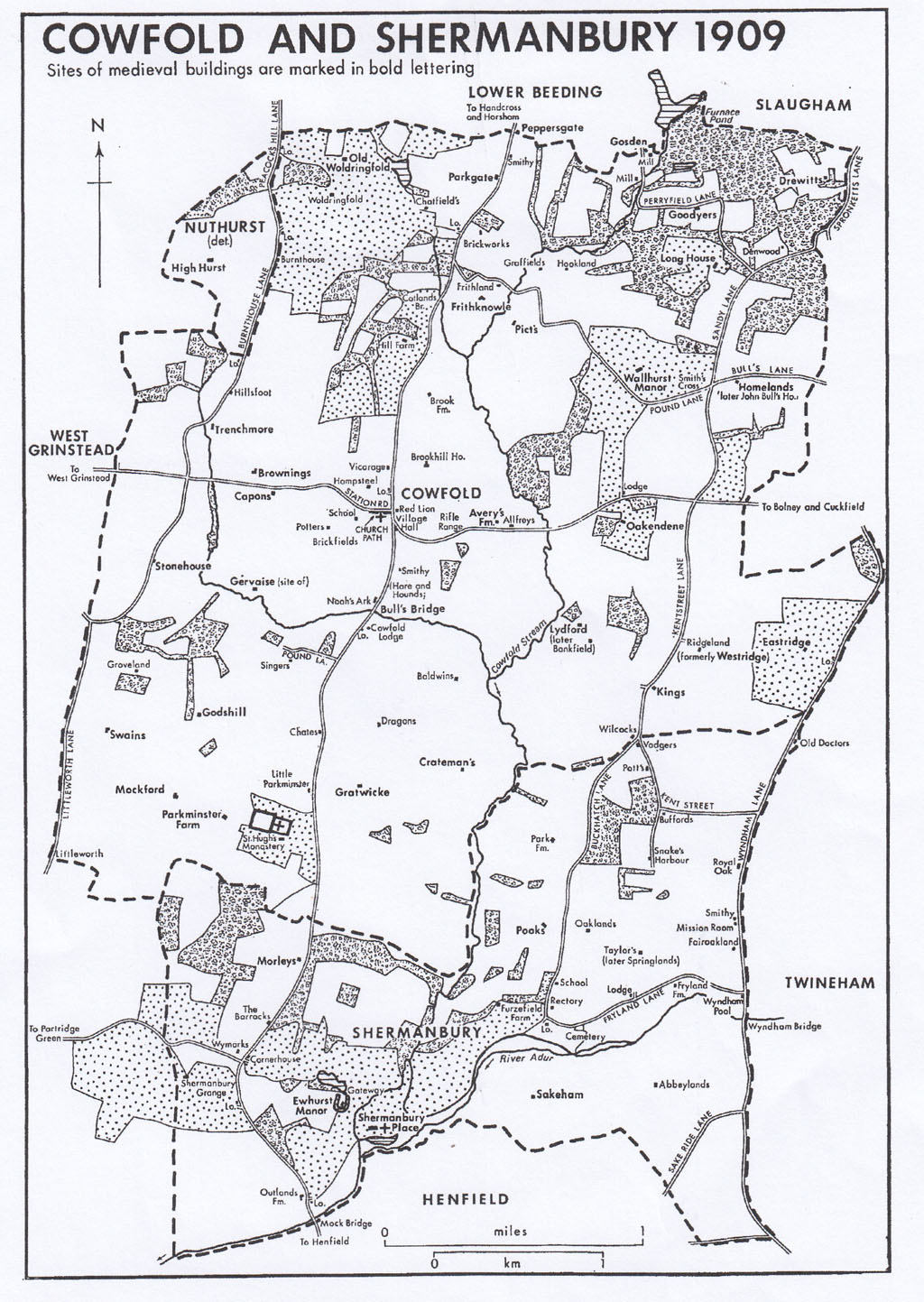
1909 Map of Cowfold and Shermanbury
Depictions of Cowfold in the 1940s, 1975 and the present day
This is a depiction of the Village in the period 1940 to 1945:
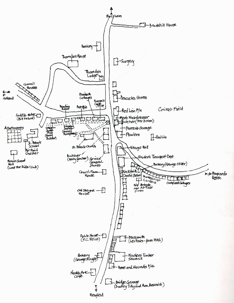
Depiction of Cowold Village in 1940 to 1945 (not to scale); Reproduced from a drawing by Eric Vincent.
This is a depiction of the Village in 1975:
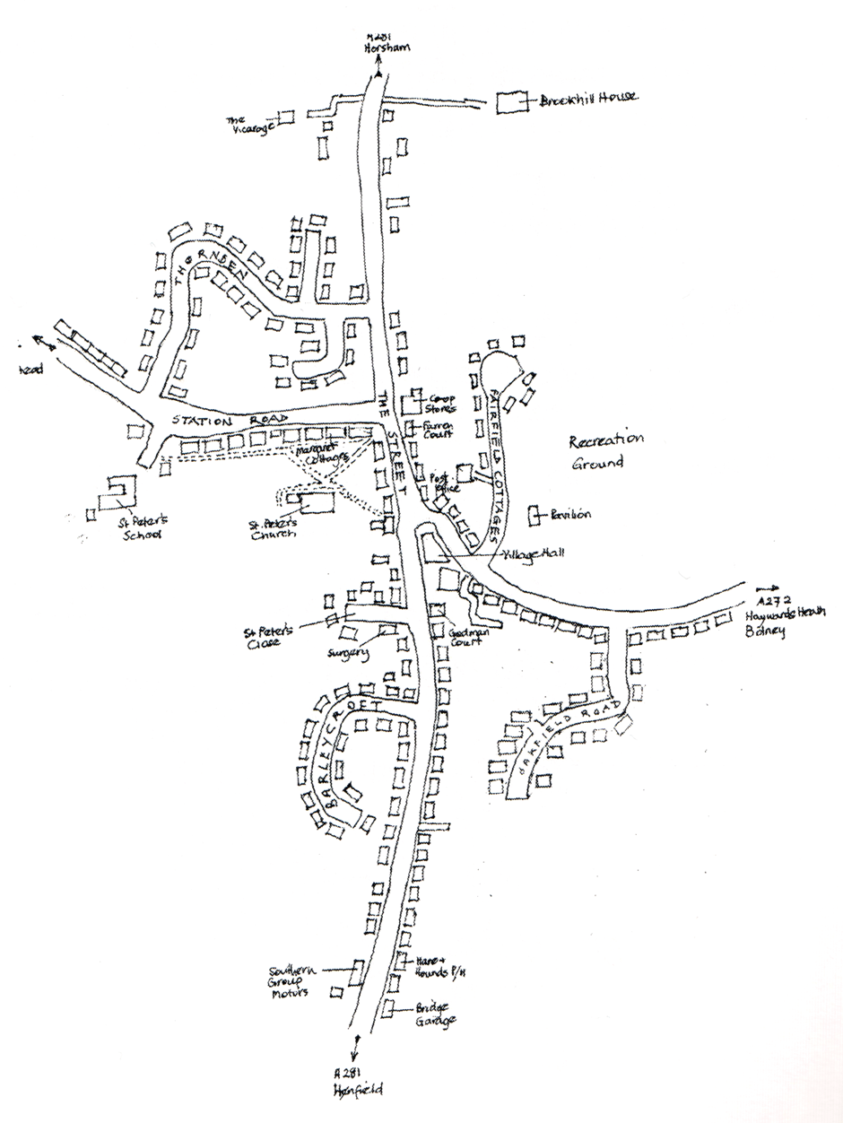
Depiction of Cowfold Village in 1975 (not to scale)
This is a depiction of the Village in the present day (2015):
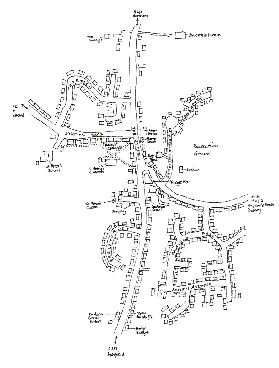
Depiction of Present Day Cowfold Village (not to scale)
1940 Aerial Photographs of Cowfold
Here is a link to an online catalogue of aerial photographs of Sussex recorded in 1940:
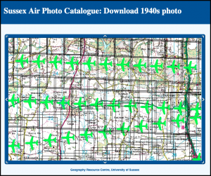
Home page of online catalogue of 1940 aerial photos of Sussex
The catalogue is provided by the Geography Research Centre at the University of Sussex and includes photos of Cowfold that can be downloaded and enlarged to show the village in greater detail.
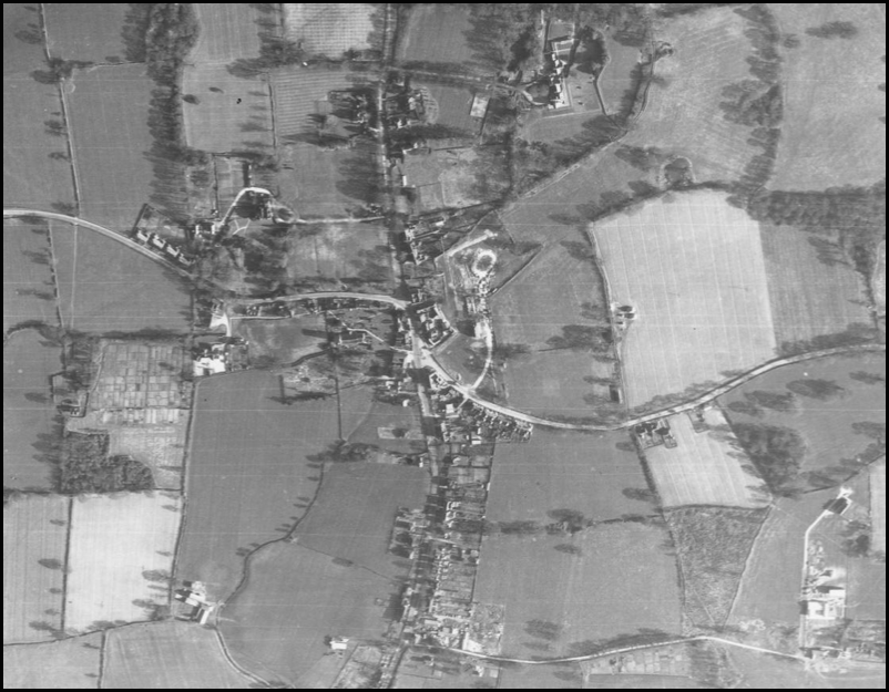
Blow-up of aerial photograph of Cowfold village
There were obviously far fewer houses in 1940 and, with the significant housing developments in the village after the war, it is not surprising that the population has almost doubled since then.
We are very grateful to Jim Parsons for alerting us to this great resource.